(This article about the Paiute ATV Trails is quite dated, much has changed since this was originally written, I offer it you for entertainment purposes only. You will want to reference more current articles on the trail system and/or the official trail map or map books.)
This article was written by Paul J. Bottino
For the last two summers I, now an easterner born and raised in Helper Utah, have spent two or three days on the Paiute ATV trail in southwestern Utah. Some publications refer to this as ATV heaven. I would agree. In five days of almost continuous riding, I have covered less than one-half of the trail. Most estimates put the main loop of the trail at about 275 miles. With all the interconnecting side trails the mileage is around 800 miles of marked trails and 1000+ miles of forest roads. This is truly an awesome experience. There are two publications that are a must for learning about and traveling on the Paiute trail. These are the book, Paiute ATV Trail System by Darlene Uzelac, Robert Uzelac and Roger Foisy. Secondly, one really needs the National Geographic Trails Illustrated Map # 708 entitled the Paiute ATV Trail. Finally, for web access to the trail information start at www.marysvale.org. This site was just revised Feb 1, 2002 and has much more detail than I will provide.
My descriptions will be two and one-half of the most interesting days I have spent riding on the trail.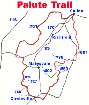
Access:
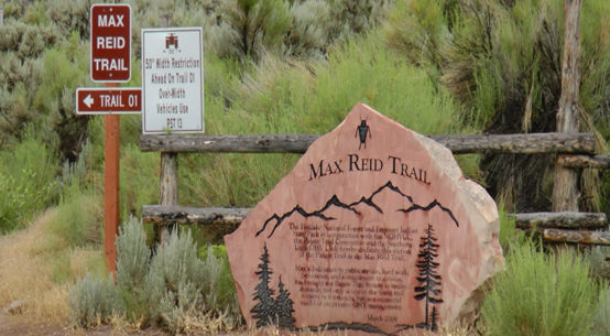
The trail does not have a beginning or an end. It consists of a large loop extending roughly from Circleville on the south to Salina on the north. To the east the trail passes through the town of Koosharem near Fish Lake and to the west along a line roughly through Filmore and Kanosh. It consists of the main loop numbered the #01 trail. This is the main Paiute trail. Then almost 100 additional trails extend in all directions off the main trail out, as well as inside the loop. Some of these are numbered and some are not. Most are on the map mentioned above. Most of the trail is located in the Fishlake National Forest. Without a beginning or an end, the trail can be accessed from several communities on the outer areas of the trail, as well as from Marysvale, the self-proclaimed hub of the trail. (It is!) These towns have ordinances permitting ATV traffic on their public streets. The streets for ATV travel are marked, and the speed limit is 10 miles per hour. This allows the rider to exit the trail into town, buy food, gas, and anything else needed. This also allows the rider to stay in clean rooms for the night. The towns that allow ATV travel on their streets are: Annabella, Aurora, Beaver, Circleville, Elsinore, Filmore, Glenwood, Joseph, Junction, Kanosh, Koosharem, Marysvale, Richfield, Salina and Sigurd.
2000 trip – Tailhead
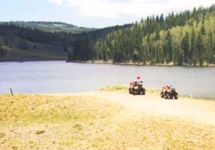
Our trip began in Marysvale. We picked up our rented ATVs at about 9 AM and headed west up the Marysvale #02 loop. I had met up with my buddy from Maryland, Gary, his son, Michael from California, and his two son-in-laws, Reed and Shawn. The #02 loop actually cuts across the trail from east to west with Marysvale in the center.
Trail
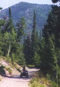 The Marysvale #02 west run is a well-traveled graded road for both ATVs and four-wheel drive vehicles. This trail goes from 5800 feet in Marysvale to 9500 feet where in intersects with the main #01 trail. Upon connecting with the main #01 trail, we turned south and continued to climb. Our objective for the day was to travel along the #01 trail, explore some side trails, and arrive in Circleville where we would stay the night. The trail continues to climb toward the highest point on the entire system.
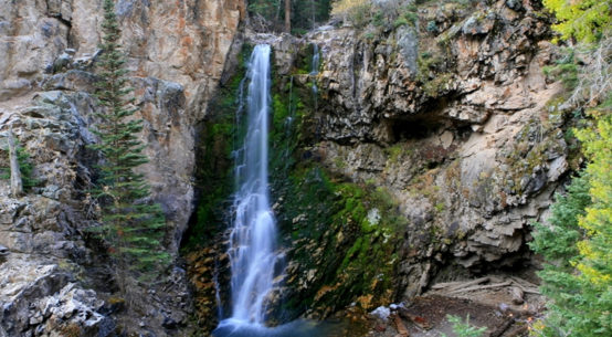
The view is spectacular. This area was once a volcanic caldera, and the remnants of volcanos are clearly in evidence. These are Delano Peak and Mt Belknap. Ecologically, and geologically this is a fantastic place.
South of the pass the trail goes down some gentle switchbacks to Mud Lake and Big Johns Flat.
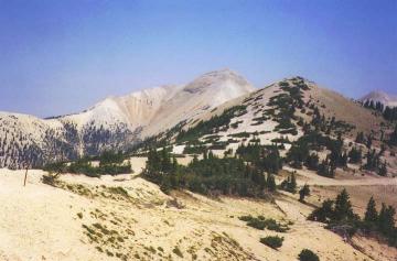
Big John’s flat is an official campground accessible with trucks, trailers, and RVs, and there will be lots of people camping there. South of Big John’s flat the trail crosses state highway 153. From here traveling south we pass through meadows, forests, and grasslands all part of the Tushar mountains. The riding is once again, fantastic. Eventually one gets to Bettenson Flats where the view back to Mt Belknap and Delano Peak is really outstanding.
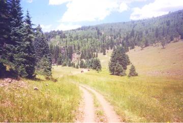
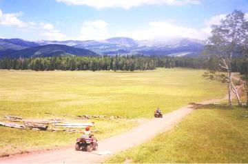 We took probably half the day riding several side trails in the Tushars off the main #01 trail. The trail eventually passes through a large grassy meadow, and drops off into Wades Canyon above Circleville.
The trip to this point with one small exception, just before crossing highway 153 is not greatly challenging for a rider with any experience. But, the trip down off the cliffs into Wades Canyon is not for the faint hearted. This consists of many sharp, steep and narrow switchbacks. I was riding a Polaris Trail Boss my first trip down and without engine compression braking it was really scary. I don’t think this part of the trail is easy, and definitely not for the novice, first time rider. Also we were very tired, and that contributed to the difficulty of the trip down the canyon. Once into Wades Canyon, the trail flattens out, and becomes a nice ride. From the mouth of the canyon, it is about a 6-mile trip through the sagebrush into Circleville. This seems like a long ride, and is rough due to dirt mounds across the trail to control runoff. Needless to say, we slept very well at the Butch Cassidy Hideout, Motel and Cafe. I can’t say enough for Jay, who runs the show in Circleville. The motel is clean, the beds are great, and the food at the Café is fantastic and cheap.
Trail Warnings
The only warning I would give is for the switchbacks just before highway 153, which are just narrow and require slow going, and the nasty switchbacks going down into Wades Canyon. I was tired, and on a machine with no compression braking it was really difficult. Fortunately we never met anyone coming up while we were going down. I really don’t know what one would do.
Difficulty
About 95% of this trip was wide trails, with some easy climbing. The only problem is the distraction because of the scenery. I would even take my wife on this trail, and she could drive her own machine. I would not let her navigate the Wades Canyon switchbacks on her own though.
Ride Stats
Elevation The trip goes from 5800 ft in Marysvale to 11400 at the top of the trail.
It then goes back down to 6000 feet in Circleville.
Mileage- According to the Uzelac book this trip to from Marysvale to Circleville is 47.3 miles.
Ride time- The time with lunch, rest stops, and scenery stops was about 9 hours.
This was a leisurely trip.
2001 Trip – Trailhead
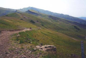
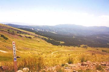
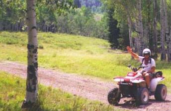
This year we went straight to Circleville, rented Honda Ranchers, and headed up Wades Canyon. This was a piece of cake this time. We went up and down Wades canyon five times with no problem. I still want to know what to do if I meet someone on those switchbacks. At the top we picked up the #88 trail and headed west. This trip went through some grassy meadows larger that several football fields. This is a loop outside of the main #01 trail. We then picked up the #27 trail and went up to Puffer Lake. The lake was not too big, and we ran into a large number of Boy Scouts at a permanent scout camp just down the trail from the lake. You can get into the Scout camp with a car off Route 153. We then proceeded back on #27 to the intersection of 27 and #26 near the main #01 trail. There are some very narrow switchbacks on #01 after coming off #27. They are not steep, but they are narrow. We then proceeded up through Big John’s flat, and up the gentle switchbacks again to the highest point on the trail. Looking back south from the peaks, you can see Elk Meadow Ski resort. It appears that we passed right by it, and didn?t even know it was there. We spent our second day this year further exploring the side trails in the Tushars.
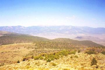
 The most outstanding day, however, was the third day when we went south out of Circleville on the #01 trail. We traveled on the streets of Circleville and then out on the trail. This is flat farmland where someone actually has a herd of buffalo. We cross some sagebrush flats, followed a dry stream bed, and then climbed up over Table Mountain. From there we dropped back down to Kingston where we crossed highway 62 in Kingston canyon. One could actually access the #01 trail at that point right off the highway. From there it is a continuous climb up a very wide gravel road. The climb is about five miles, and then we came out onto the Sevier Plateau. From there on for many miles if one stays high, there is spectacular views to the west of the Tushar mountains, where we had ridden for two previous days, as well as Delano Peak, and Mt Benknap farther north.
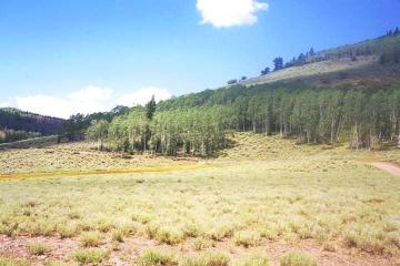
 You can also see down into the valley to the Paiute Reservoir to the west, and down to Otter Creek Reservoir to the east. The view is really outstanding. Most of the riding is in the open, but in continuing to climb up to the head of Pole Canyon you pass through huge stands of pine and aspen. This was a very surprising and rewarding ride. You can head off to the east down Pole canyon on #72 or down to Otter Creek Reservoir on #73, but we chose to take the high road and keep climbing. It was definitely worth it. The trail continues on up to Langdon Peak. There are lots of cattle grazing everywhere.
Near Langdon Peak the #53 trail branches off #01 and forms a large circle to the east, then north, and then back to the #01 trail. Proceeding north on #01 we passed by Manning Meadow reservoir. This is a beautiful little body of water, with a number of nice log cabins just beyond. The Utah State Fish and Game use it as a brooding facility for cutthroat trout.
 It is only catch and release for some part of the year. We proceeded north along #01 then to the left on #78 to Monroe peak. There is a very large radio antenna on the peak. This peak is so high, and the antenna so big, you can see it from Richfield. This is a dead end, so we turned around and started to backtrack down #78 and then south on #01. We proceeded down #01 and eventually intersected with #02, the eastern leg of the Marysvale Loop. We turned west on #02 and headed down into the valley. This is a very nice trip down Dry Creek Canyon. The road is narrow, but good. We dropped through cliffs and tall pines into the valley below and the trail is not very difficult. The trail then opens out into the flood plain into the valley. In the valley there were two choices, stay on #02 across the bottom of the valley, pick up #35 and head south to Junction, or take #25 down the east side of the valley to the top of Paiute Reservoir cross on not a real trail, and connect with #35 again, and proceed south to Junction. We took the #02-#35 route. #35 crosses highway 89 just above Junction, and from there we picked up #33 for the trip west to intersect with the #01 trail below Wades Canyon, and then on to Circleville. This was a wonderful day, filled with some outstanding scenery from very high elevations. I highly recommend it. It is a long day though.
Trail Warnings
This is a long day, but not very difficult. It presents the rider with a wide variety of riding, from long climbs on good trails, to heavy timber on the flat, to open sagebrush flats where you can see forever. There were no technically difficult areas on this trip. There were cattle in the road a lot of places.
Difficulty
Anyone with some riding experience could make this trip. It does require lots of endurance, as it is long.
Ride Stats
Elevation-This trip starts out at 6000 feet in Circleville, goes up to nearly 10000
feet at Landon Peak, and eventually back down into the valley at 5800-6000 feet. Although we didn’t go clear to the tip of Monroe Peak it is 11226 feet.
Mileage- I estimate roughly this is at least a 75 mile trip.
Time- This is a minimum of 9 hours of steady riding. We didn’t rest as much this day as we had previous days. It is long, but worth it.
In five days of riding the trail I have not covered even half of the Paiute trail. I would have to agree that this is the finest ATV riding in the country. It just seems to go on forever. So to all my ATV brothers (and sisters) in Utah, if you haven’t ridden the Paiute trail, do it this weekend, and as old Roy used to say? Happy trails to you?
Disclaimer: This post has information in it that may have changed since its initial publication in April 2004 and is posted for entertainment purposes, please see the Disclaimer page for the site.