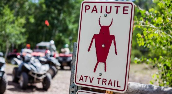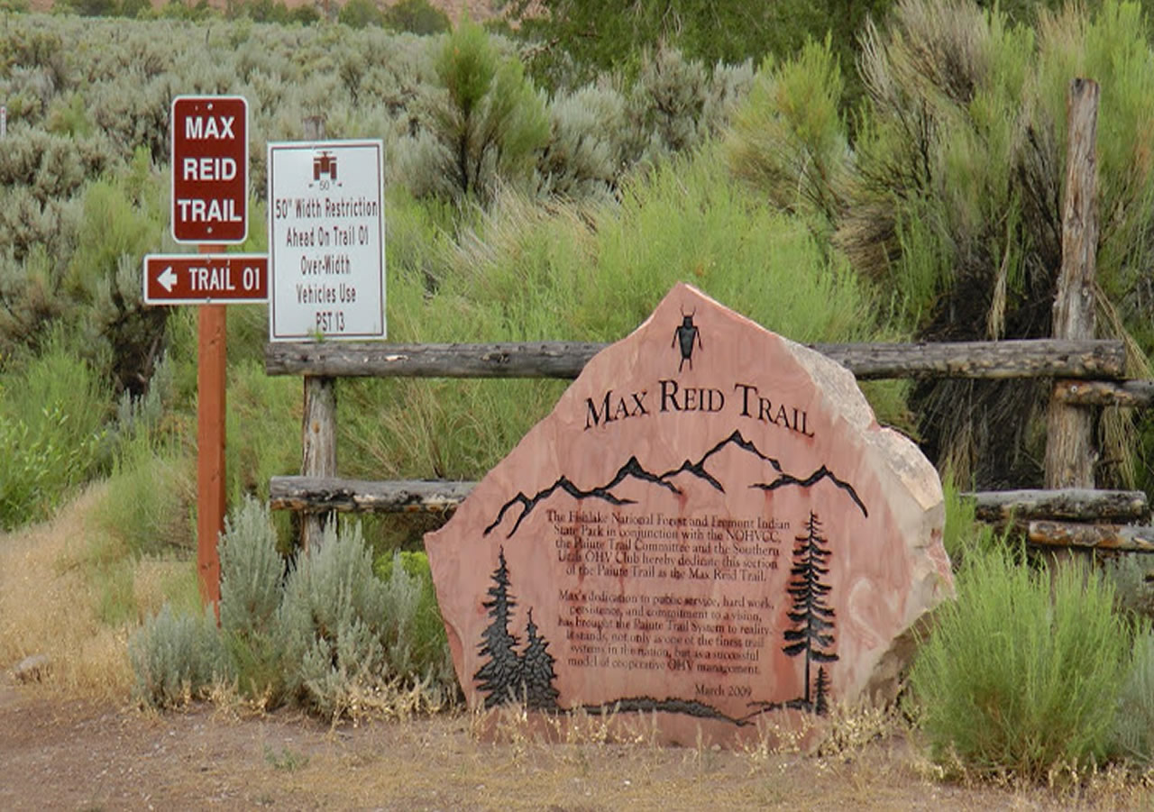
The Max Reid Trail is also known as the Jo Lott Trail. The Paiute Trail, with its hundreds of miles of ATV accessible routes, has several parts that are SUV accessible. Indeed in some areas you will be able to ride a Winnebago along some parts of the well maintained, yet dirt road. Part of the trail described here below is just such a trail. Honestly, that is not the type of accommodation that we look for in an ATV trail though, is it? What we really enjoy is the narrow two track that is passable by nothing wider than an ATV. Well, the good news is that there is plenty of that on the Paiute Trail too. The trail that proceeds up Dry canyon, known by my friends as “Enchanted Forest” is a ride worthy of any devoted ATVer. It is one of those sweet spots that you wouldn’t mind keeping all to yourself, were that possible.
Access:
 From the middle of the Salt Lake Valley go south on I-15 through the constantly slow traffic in Provo, all the way to Nephi. At Nephi you have a choice.
If you enjoy the ride through small towns like Levan, Gunnison and Salina, with a stop at the Picnic Basket Drive-In (formerly Johnson’s Drive in), as I do, then take an exit on exit 222 and go south to I-70. Then take I-70 west to Richfield. Richfield is a great place to hang your hat for the night. This time I tried out the accommodations at the Travel Lodge. It was much nicer than the camping alternative and a great restaurant right in the building. After a good night’s sleep you can continue your trip the next morning a brief 20 miles to exit 17, the Freemont Indian Museum State Park exit. (You see the museum before you see the exit). At Exit 17 turn left (south) and cross over the freeway bridge. When you hit the dirt road turn right and follow the dirt road just about a mile. There is an overflow parking area perfect for staging when you are not going to use the camping area as a staging area. The campground is a fee area.
If you prefer to stay on the freeway at Nephi, you can do that too. It may be a little faster, but it may cost you an extra couple of gallons of gas. Stay on I-15 to the interchange with I-70 near Cove Fort. Take the I-70 exit and go east to exit 17, this is also known as the Freemont Indian Museum State Park exit. The Museum is to your left. However you turn to the right at the top of the exit and go one mile toward the campground. You may use the campground as your trailhead or you may use the overflow parking area as your trailhead. The overflow parking area will save you from paying the fee for the campground.
Trailhead:
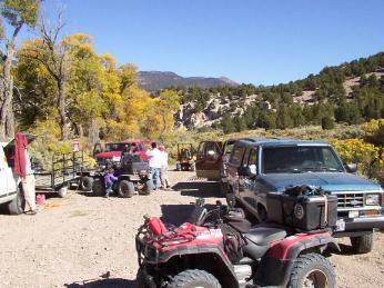 The Freemont Indian State park offers a camping area that is nice and includes rest rooms. It is called “Castle Rock Campground” However, it is only open for public use during the normal Summer Season. We arrived just a few days after labor day and found the rest rooms closed. I wonder what they think the Fall visitors will do for rest room facilities? There are improved camping areas at the campground, but no electricity or RV dumping station.
The closest medical facility is the hospital in Richfield. That would be the second Richfield exit as you are going east. Then turn right, the hospital is on your left. (Follow the blue signs)
Trail:
Using the campground as a trail head will cause you to back track just a bit to the Paiute Trail marker. It is easy to spot. It takes you back to the east over the hill to the gate on the opposite side of the freeway from the Museum. The gate will offer you a map of the area in the kiosk. Some folks will use that area as a staging area, but it was closed due to construction and repaving of the road to the museum while we were there.
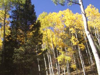
Down below the trail looks rather desolate as you start south and up the Tushar mountains. The trail is well marked. You will cross a stream and then through a gate. Be sure to close the gate when you are through it. About the time you encounter the first stand of Quaking Aspen trees you enter the Fish Lake National Forest. You will pass through the stream on several occasions during your climb up the mountain.
Watch for a fork in the trail on your right. N38 30.716 W112 20.796 at about 7914 feet. It will take you off the jeep/SUV route, up Dry Creek Canyon. There is a sign that marks the trail as Joe Lott Trail. (Don’t be confused as you look at your map. Joe Lott canyon is actually the next canyon to the west of Dry Canyon) In times past this route up Dry Canyon was considered a side route, but now it is signed as the Paiute Trail 01 route. The other jeep/SUV route is now the side route.
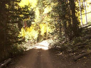
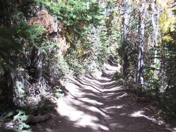
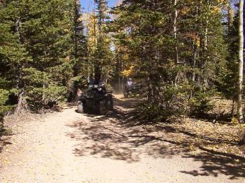
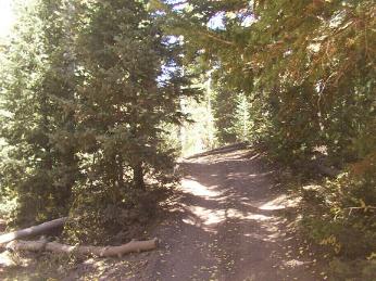
We found the spot just past the gate as an excellent stop for a snack. From this point on up to the ridge line you will find some mighty fine ATVing. It is a narrow two track trail you may have dreamed about. The folks I did this trip with refer to this part of the trail as “enchanted forest.” It is worthy of just such a name. The trees cover the trail almost all the way to the top and there are plenty of turns and switchbacks to keep the trail good and interesting.
 When you reach the top you come to an intersection with a main part of the Paiute Trail. GPS:N38 29.052 W112 21.983 at 9561 feet in elevation). Going to the right will take you over to Kimberly, an old mining district of the 19th Century. It is an interesting area, but you could do it in your buick The trail had been recently maintained when we were there. If you continue on north from Kimberly you could loop around to Sevier Canyon where you can follow the freeway back to the Castle Rock Campground. That was not the route we chose on our ride. We wanted to reach some high ground. This was about half the distance to our remote point on the trail.
If you have a need to go to the Big Rock Candy Mountain, you can take the “Deer Creek Trail” it is well marked, but not for its destination. That intersection is at N38 28.035 W12 21.889 at 8742 in elevation
You will also pass the route that goes down to Marysvale at :N38 24.215 W112 23.788 at 10990 feet in elevation.
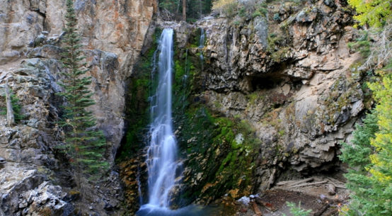
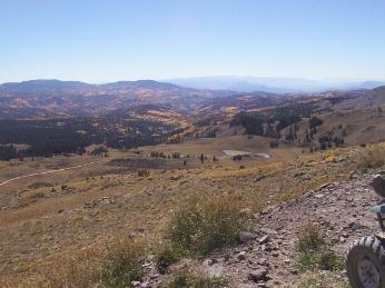
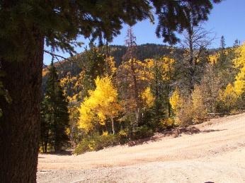 There are lot of beautiful views along this stretch. You climb up above the timberline and trek along for miles and miles. If you have trouble breathing at high altitudes, you’d better bring along your O2 bottle.
We reached the pass near Mud Lake, the highest point along the Paiute Trail after about 4 hours from the trailhead. Looking southwest you can see a ski resort and to the west clear into Nevada. That vantage point is pretty awesome (GPS N38 23.153 W112,23.847 at 11500 feet in elevation.)
You can go on from that point clear over to Beaver or Circleville, take your pick. We turned around and headed back to our trail head following our same route. Somehow the ride back is always a bit quicker than the ride up.
This is a really beautiful place to ride. You’ll enjoy every minute.
Cautions:
Remember that speed kills…..
As always, on trails that accommodate both ATVs and SUV’s take special caution at blind corners and never ride two abreast. If out riding during the elk or deer hunt it is recommended that you wear hunter orange, not only to be in style with everyone else, but to permit you to be clearly distinguished from the game animals. One never knows how much intoxicating beverage a hunter may have consumed.
Difficulty:
Intermediate trail. Steep Narrow two track trail in some places. Not for the first time rider.
Ride Stats:
Ride Time 4 Hours
Low Elevation 6133 feet at Trailhead
High Elevation 11500 feet at N38 23.153 W112,23.847 Mud Lake Pass
Trail Length 42 Miles
Travel Time 3 Hours
Average Speed 11 MPH
GPS Coordinates at Trailhead: N38 33.487 W112 21.307 Elevation: 6133 feet
Disclaimer: This post has information in it that may have changed since its initial publication in April 2004 and is posted for entertainment purposes, please see the Disclaimer page for the site.